Agricultural orthomosaic mapping will give you the information you need to improve your harvest. From elevation and drainage maps to initial stand counts and crop health throughout the year. Drones can assist in tracking storm damage and assessing area, simplifying the insurance claim process.
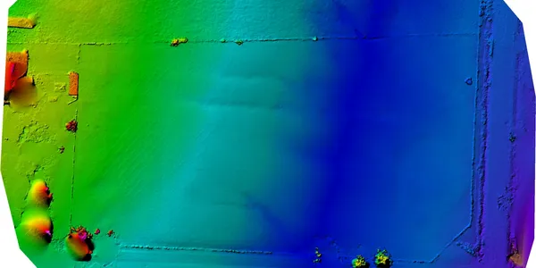
One time or full project life mapping and photography to assist in tracking progress, briefing stakeholders, tracking materials, conducting inspections, or risk mitigation. Through the use of photogrammetric processes and orthomosaic mapping, tracking a project through its entire lifecycle has never been easier. Using the drone to approach elevated areas speeds up an inspection and reduces the risk to personnel assigned to the same task.
Agricultural orthomosaic mapping will give you the information you need to improve your harvest. From elevation and drainage maps to initial stand counts and crop health throughout the year. Drones can assist in tracking storm damage and assessing area, simplifying the insurance claim process.
One time or full project life mapping and photography to assist in tracking progress, briefing stakeholders, tracking materials, conducting inspections, or risk mitigation. Through the use of photogrammetric processes and orthomosaic mapping, tracking a project through its entire lifecycle has never been easier. Using the drone to approach elevated areas speeds up an inspection and reduces the risk to personnel assigned to the same task.