Quality Construction Drone Services in Kansas City
Drones have revolutionized the construction industry by providing unmatched precision and efficiency. From aerial photography to orthomosaic mapping, construction drones save time, reduce costs, and ultimately improve project outcomes. At Have Drone Will Travel, we specialize in providing top-tier construction drone services in Kansas City and the surrounding areas. Whether you need orthomosaic mapping or high-quality photography, our expertise ensures your project’s success.
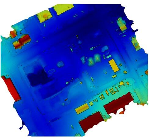
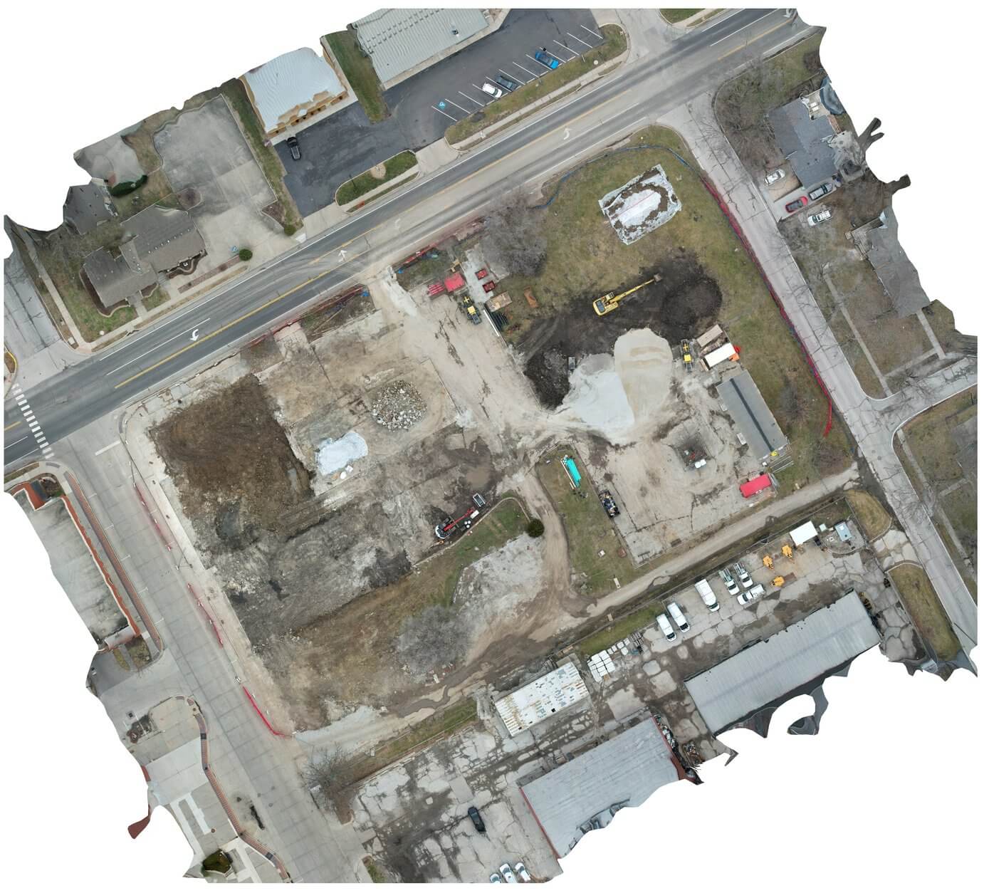
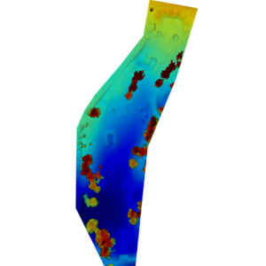
Photogrammetry is a precise method that utilizes photographs to measure distances, shapes, and volumes. In the construction industry, it is indispensable for generating accurate site plans, monitoring project progress, and confirming measurements. By employing drones, image collection becomes markedly more efficient, capturing high-resolution imagery that facilitates the development of detailed 3D models and orthomosaic maps. These advanced tools are vital to the success of modern construction projects.
Check Out Our Expert Drone Services for Construction
Have Drone Will Travel offers a comprehensive range of drone services tailored to the construction industry. From mapping to marketing, our solutions are designed to meet your specific needs.
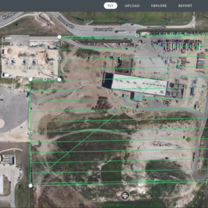
Orthomosaic Mapping for Construction
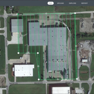
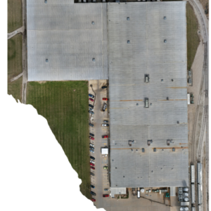
Orthomosaic maps are detailed, georeferenced aerial images stitched together from drone-captured photographs. These maps are invaluable for project planning, monitoring, and reporting. With orthomosaic drone mapping, you gain accurate visuals of your construction site, enabling better decision-making and progress tracking.
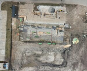
High-quality drone photography and videography bring a new perspective to construction documentation and marketing. Showcase your projects to stakeholders or create compelling marketing materials with stunning aerial shots captured by our drones. Our professional imagery highlights the scale and precision of your work.
We utilize DroneDeploy, a leading cloud-based software, to transform aerial images into precise, measurable orthomosaic maps. This enables us to generate detailed 3D models, measure distances and volumes, and produce comprehensive client reports with ease. Additionally, DroneDeploy allows us to overlay orthomosaic maps from different dates, providing a clear visual of project progress.
The Advantages of Working With Have Drone Will Travel
Choosing Have Drone Will Travel means partnering with experienced professionals dedicated to delivering quality results. With deep knowledge of the Kansas City area and expertise in construction drone services, we’re your trusted partner for aerial solutions. Our commitment to accuracy, efficiency, and customer satisfaction sets us apart from the competition.
Pricing
Cost structure for an orthomosaic is dependent on the size of the site and if the customer is wanting additional photogrammetry “add-ins” such as ground control points or analysis. Call for pricing information.
Hear From Our Satisfied Construction Drone Service Clients
Our clients trust us to deliver exceptional drone services for their construction projects. Here’s what they have to say:
“Wes did a fantastic job was very professional. We will be using him on other projects in the future. Highly recommend him!"
Penny B.
“The attention to detail and focus during meetings is absolutely reflected in his work. The video footage is crisp, clear and smooth. Look no further, I highly recommend this company!”
Cindy C.
Reach Out Today for a Free Quote on Your Next Construction Project!
Ready to see how our drone services can transform your construction project? Contact Have Drone Will Travel today for a free quote or to schedule a consultation. Let us help you achieve precision, efficiency, and excellence in your next project.