

Construction & Development Services
Progress documentation, mapping deliverables, stockpile estimates, and excavation visibility for contractors, owners, and project teams across the Kansas City region.
Construction projects generate constant change. Have Drone Will Travel provides scheduled aerial documentation and mapping support that helps general contractors, owners, civil contractors, excavation teams, and project managers see what is happening on site without traveling there. Our visual records support better decisions, clearer communication, fewer unnecessary site visits, and stronger documentation from groundbreaking through final walkthrough.
Each capability is designed to give project teams practical visual information for planning, tracking, and communication.
Scheduled aerial photo sets and before/during/after comparisons at key milestones.
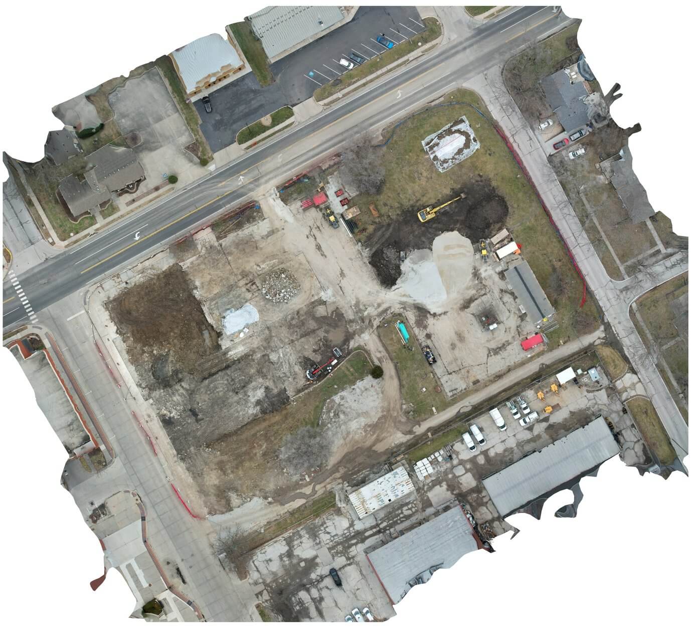
Stitched aerial overviews of the site, updated periodically to track changes.
Visual estimates of material quantities and volume changes over time.
Visual documentation of cut and fill progress and earthwork conditions.
Organized visual updates for owners with clear imagery for team meetings.
Our construction support services are designed for the people who plan, build, and oversee projects.
Track subcontractor progress, document milestones, and keep owners informed with consistent visual updates.
See site conditions without traveling. Review progress remotely and make decisions with current imagery.
Document earthwork progress, track stockpile changes, and communicate site balance visually.
Reduce site visits, improve reporting, and keep stakeholders aligned with organized visual documentation.
Deliverables are organized for practical use by project teams, owners, and stakeholders.
From initial discussion to organized deliverables, the process stays straightforward and communication stays clear.
Share the project location, timeline, and the type of documentation you need. We help determine the right capture approach.
We plan flight paths, capture schedules, and deliverable formats based on your project goals and site conditions.
We fly the site on the agreed schedule, capturing photos, video, or mapping data as the project progresses.
You receive processed photos, maps, and documentation organized for your team, owners, and stakeholders.
Important note: Deliverables are intended for visual documentation, planning support, communication, and measurement support. They are not a replacement for licensed surveying, civil engineering, structural engineering, official safety certification, or other regulated professional services. Have Drone Will Travel provides visual data capture and documentation services to support qualified professionals and project teams.
Send the project location, timeline, and the type of documentation you need, and we will recommend a practical capture plan.